
パトゥムターニー topographic map
Interactive map
Click on the map to display elevation.
About this map
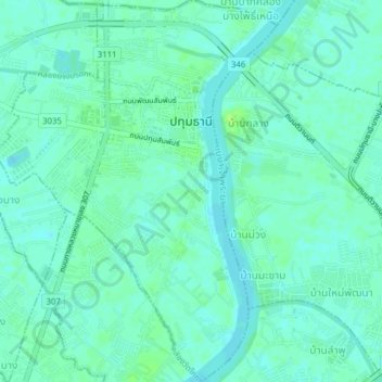
Name: パトゥムターニー topographic map, elevation, terrain.
Location: パトゥムターニー, อำเภอเมืองปทุมธานี, パトゥムターニー県, タイ王国 (13.99465 100.51387 14.03233 100.54276)
Average elevation: 5 m
Minimum elevation: 0 m
Maximum elevation: 12 m