
Tsiu Keng topographic map
Interactive map
Click on the map to display elevation.
About this map
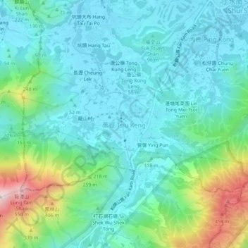
Name: Tsiu Keng topographic map, elevation, terrain.
Location: Tsiu Keng, North District, New Territories, Hong Kong, China (22.45662 114.08713 22.49662 114.12713)
Average elevation: 130 m
Minimum elevation: 5 m
Maximum elevation: 572 m
Other topographic maps
Click on a map to view its topography, its elevation and its terrain.
Princess Hill
China > Hong Kong > North District
Princess Hill, North District, New Territories, Hong Kong, China
Average elevation: 61 m