Geolocate

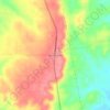
Alto topographic map

Click on the map to display elevation.

Alto

The town of Alto was laid out in 1849 and named for the Spanish word meaning "high" on account of the site's elevation on a drainage divide between the Neches and Angelina Rivers.

Wikipedia (CC-BY-SA 3.0)

About this map

Name: Alto topographic map, elevation, terrain.

Location: Alto, Cherokee County, Texas, United States (31.63611 -95.09026 31.66238 -95.05245)

Average elevation: 130 m

Minimum elevation: 106 m

Maximum elevation: 163 m

Other topographic maps

Click on a map to view its topography, its elevation and its terrain.
Pryor Mountain

United States > Texas > Cherokee County

Average elevation: 158 m

Mount Selman

United States > Texas > Cherokee County

Average elevation: 173 m

Morrill

United States > Texas > Cherokee County

Average elevation: 107 m

Mount Selman

United States > Texas > Cherokee County

Average elevation: 173 m

Gear up for your next adventure:

🧥Thermal Emergency Blankets - Compact Mylar blankets to prevent hypothermia if stranded overnight
🧯Animal Deterrent Spray - Safety spray for wildlife
🥾Heavy Duty Hiking Boots - Ankle-supporting boots for carrying heavy packs on steep contours
🥤Outdoor Water Bottles - Reusable bottles for outdoor activities
🏕️Camping Gear - Essential camping equipment

As an Amazon Associate, this site earns from qualifying purchases at no extra cost to you.