
Chaudfontaine topographic map
Interactive map
Click on the map to display elevation.
About this map
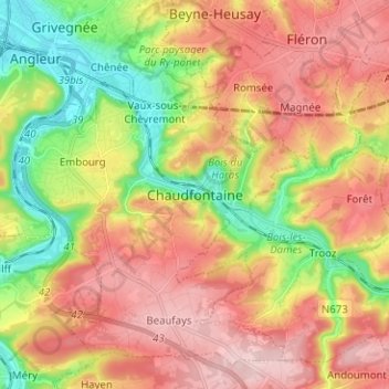
Name: Chaudfontaine topographic map, elevation, terrain.
Location: Chaudfontaine, Luik, Wallonië, 4050, België (50.54479 5.60697 50.62479 5.68697)
Average elevation: 187 m
Minimum elevation: 62 m
Maximum elevation: 301 m