Geolocate

Migneint topographic map

Click on the map to display elevation.

About this map

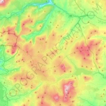
Name: Migneint topographic map, elevation, terrain.

Location: Migneint, Cwm Penmachno, Conwy, Wales, United Kingdom (52.90413 -3.94618 53.05993 -3.63461)

Average elevation: 363 m

Minimum elevation: 31 m

Maximum elevation: 862 m

Gear up for your next adventure:

🪑Portable Backpacking Chairs - A comfortable seat for studying maps at the end of the day
🎒Dry Bags - Waterproof bags for outdoor gear
🛰️Handheld GPS Units - Rugged GPS devices for tracking coordinates and elevation in the Australian bush
🚴Cycling Backpacks - Backpacks for cyclists
🥶Thermal Beanies - Warm hats for cold hikes

As an Amazon Associate, this site earns from qualifying purchases at no extra cost to you.