Geolocate

Ratter Corner topographic map

Click on the map to display elevation.

About this map
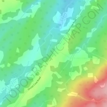
Name: Ratter Corner topographic map, elevation, terrain.

Location: Ratter Corner, Sussex Parish, Kings County, New Brunswick, Canada (45.63062 -65.59822 45.65062 -65.57822)

Average elevation: 147 m

Minimum elevation: 96 m

Maximum elevation: 249 m

Other topographic maps

Click on a map to view its topography, its elevation and its terrain.

Town of Sussex

Canada > New Brunswick > Kings County

Average elevation: 60 m

Havelock Parish

Canada > New Brunswick > Kings County

Average elevation: 90 m

Town of Rothesay

Canada > New Brunswick > Kings County

Average elevation: 51 m

Town of Hampton

Canada > New Brunswick > Kings County

Average elevation: 88 m

Town of Rothesay

Canada > New Brunswick > Kings County

Average elevation: 54 m

Town of Sussex

Canada > New Brunswick > Kings County

Average elevation: 59 m

Gear up for your next adventure:

👣Snake & Scrub Gaiters - Protection against spinifex, mud, and snakes while walking off-track
🍳Camping Cookware - Cookware sets for outdoor meals
🔦LED Torches - LED torches for outdoor use
🐍Australian Snake Bite Kits - Specific pressure immobilization bandages for Australian venomous snakes
⌚Altimeter Barometer Watches - Outdoor watches with built-in sensors to track altitude changes and weather shifts

As an Amazon Associate, this site earns from qualifying purchases at no extra cost to you.