
Payrin-Augmontel topographic map
Interactive map
Click on the map to display elevation.
Payrin-Augmontel
La superficie de la commune est de 1 284 hectares ; son altitude varie de 185 à 370 mètres.
About this map
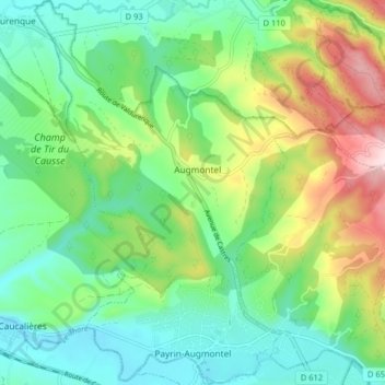
Name: Payrin-Augmontel topographic map, elevation, terrain.
Average elevation: 288 m
Minimum elevation: 190 m
Maximum elevation: 497 m