
Vergaville topographic map
Interactive map
Click on the map to display elevation.
About this map
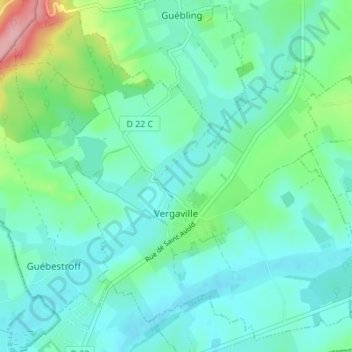
Name: Vergaville topographic map, elevation, terrain.
Average elevation: 232 m
Minimum elevation: 204 m
Maximum elevation: 335 m
Other topographic maps
Click on a map to view its topography, its elevation and its terrain.
Bois des Dames
France > Grand Est > Moselle > Vergaville
Bois des Dames, Vergaville, Sarrebourg-Château-Salins, Moselle, Grand Est, France métropolitaine, 57260, France
Average elevation: 221 m