
Maré Island topographic map
Interactive map
Click on the map to display elevation.
About this map
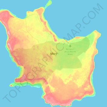
Name: Maré Island topographic map, elevation, terrain.
Average elevation: 34 m
Minimum elevation: -1 m
Maximum elevation: 124 m
Other topographic maps
Click on a map to view its topography, its elevation and its terrain.
Lifou
France > Loyalty Islands Province
Lifou, Loyalty Islands Province, New Caledonia, 98820, France
Average elevation: 16 m
Ouvéa
France > Loyalty Islands Province
Ouvéa, Loyalty Islands Province, New Caledonia, France
Average elevation: 1 m