
Boga topographic map
Interactive map
Click on the map to display elevation.
About this map
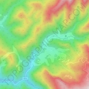
Name: Boga topographic map, elevation, terrain.
Location: Boga, Pietroasa, Bihor, 417365, Romania (46.58435 22.62425 46.62435 22.66425)
Average elevation: 748 m
Minimum elevation: 431 m
Maximum elevation: 1,164 m
Other topographic maps
Click on a map to view its topography, its elevation and its terrain.