
Zárate topographic map
Interactive map
Click on the map to display elevation.
About this map
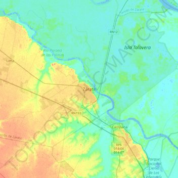
Name: Zárate topographic map, elevation, terrain.
Location: Zárate, Partido de Zárate, Buenos Aires, 2800, Argentina (-34.13577 -59.06423 -34.05577 -58.98423)
Average elevation: 14 m
Minimum elevation: -6 m
Maximum elevation: 40 m