
El Carmen topographic map
Interactive map
Click on the map to display elevation.
About this map
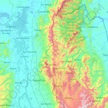
Name: El Carmen topographic map, elevation, terrain.
Average elevation: 528 m
Minimum elevation: 18 m
Maximum elevation: 3,015 m
Other topographic maps
Click on a map to view its topography, its elevation and its terrain.
La Division
La Division, Abrego, Norte de Santander, Colombia
Average elevation: 1,377 m