
Thank you for supporting this site ❤️
Make a donation
Make a donation
Gear up for your next adventure:
As an Amazon Associate, this site earns from qualifying purchases at no extra cost to you.
Busasamana topographic map
Click on the map to display elevation.
Thank you for supporting this site ❤️
Make a donation
Make a donation
Gear up for your next adventure:
As an Amazon Associate, this site earns from qualifying purchases at no extra cost to you.
About this map
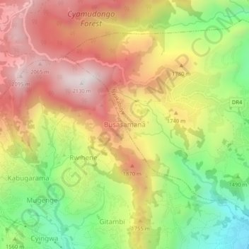
Name: Busasamana topographic map, elevation, terrain.
Location: Busasamana, Nyakabuye, Rusizi, Western Province, Rwanda (-2.58895 28.97360 -2.54895 29.01360)
Average elevation: 1,655 m
Minimum elevation: 1,164 m
Maximum elevation: 2,116 m
Thank you for supporting this site ❤️
Make a donation
Make a donation
Gear up for your next adventure:
As an Amazon Associate, this site earns from qualifying purchases at no extra cost to you.