
Ourt topographic map
Interactive map
Click on the map to display elevation.
About this map
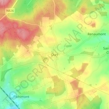
Name: Ourt topographic map, elevation, terrain.
Average elevation: 509 m
Minimum elevation: 453 m
Maximum elevation: 565 m
Other topographic maps
Click on a map to view its topography, its elevation and its terrain.
Wideumont
België > Luxemburg > Neufchâteau > Saint-Marie-Chevigny
Wideumont, Saint-Marie-Chevigny, Libramont-Chevigny, Neufchâteau, Luxemburg, Wallonië, België
Average elevation: 498 m