Geolocate

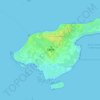
Rebild topographic map

Click on the map to display elevation.

About this map

Name: Rebild topographic map, elevation, terrain.

Location: Rebild, Rebild Municipality, North Denmark Region, 9520, Denmark (56.81134 9.82950 56.85134 9.86950)

Average elevation: 61 m

Minimum elevation: 3 m

Maximum elevation: 110 m

Other topographic maps

Click on a map to view its topography, its elevation and its terrain.

Pebermosen

Denmark > North Denmark Region > Grindsted > Vandsted

Average elevation: 39 m

Læsø

Denmark > North Denmark Region

Average elevation: 1 m

Lindholm Høje

Denmark > North Denmark Region > Aalborg

Average elevation: 14 m

Vendsyssel

Denmark > North Denmark Region

Average elevation: 10 m

Mors

Denmark > North Denmark Region

Average elevation: 12 m

Bulbjerg

Denmark > North Denmark Region

Average elevation: 8 m

Egholm

Denmark > North Denmark Region > Aalborg

Average elevation: 1 m

Gear up for your next adventure:

🧤Hiking Gloves - Protective gloves for outdoor use
🥾Hiking Gaiters - Leg protection for trails
📚Map Reading & Navigation Guides - Master the art of interpreting topographic contours and symbols
🔦Powerful LED Headlamps - Hands-free lighting for night navigation and setting up camp after dark
🧳Outdoor Travel Organizers - Gear organization accessories

As an Amazon Associate, this site earns from qualifying purchases at no extra cost to you.