Geolocate

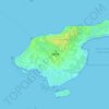
Jerslev topographic map

Click on the map to display elevation.

About this map

Name: Jerslev topographic map, elevation, terrain.

Location: Jerslev, Brønderslev Municipality, North Denmark Region, 9740, Denmark (57.26474 10.07323 57.30474 10.11323)

Average elevation: 42 m

Minimum elevation: 15 m

Maximum elevation: 72 m

Other topographic maps

Click on a map to view its topography, its elevation and its terrain.

Skivum

Denmark > North Denmark Region

Average elevation: 32 m

Pebermosen

Denmark > North Denmark Region > Grindsted > Vandsted

Average elevation: 39 m

Læsø

Denmark > North Denmark Region

Average elevation: 1 m

Lindholm Høje

Denmark > North Denmark Region > Aalborg

Average elevation: 14 m

Vendsyssel

Denmark > North Denmark Region

Average elevation: 10 m

Mors

Denmark > North Denmark Region

Average elevation: 12 m

Bulbjerg

Denmark > North Denmark Region

Average elevation: 8 m

Egholm

Denmark > North Denmark Region > Aalborg

Average elevation: 1 m

Gear up for your next adventure:

👖Convertible Hiking Trousers - Zip-off legs to adapt to changing temperatures throughout the day
🛠️Outdoor Repair Kits - Gear repair kits
📻Handheld UHF Radios - Critical communication for groups in the Australian outback
🎒Tactical Waist Packs - Quick access to your compass, phone, and snacks while walking
🧢Outdoor Sun Hats - Sun protection hats for hiking

As an Amazon Associate, this site earns from qualifying purchases at no extra cost to you.