
Clayton topographic map
Interactive map
Click on the map to display elevation.
About this map
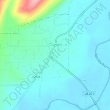
Name: Clayton topographic map, elevation, terrain.
Location: Clayton, Pushmataha County, Oklahoma, 74536, United States (34.57541 -95.37129 34.59851 -95.34265)
Average elevation: 188 m
Minimum elevation: 162 m
Maximum elevation: 330 m
Clayton, located in the Kiamichi River valley, is framed on its west by Flagpole Mountain (1,562 ft.) and to its east by unnamed mountains topping 1,600 feet in elevation. Within a few miles of Clayton is scenic McKinley Rocks, a collection of massive boulders strewn across a mountain top. South of Clayton is Clayton Lake State Park—which is surrounded by a pine tree forest—and northwest of town is Sardis Lake, a U.S. Army Corps of Engineers dam which impounds the water of Jack's Fork Creek. The Pushmataha Wildlife Refuge is also nearby, featuring scenic views from its mountain summit.