
Quartier Halberg topographic map
Interactive map
Click on the map to display elevation.
About this map
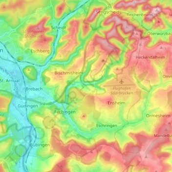
Name: Quartier Halberg topographic map, elevation, terrain.
Average elevation: 287 m
Minimum elevation: 186 m
Maximum elevation: 407 m
Other topographic maps
Click on a map to view its topography, its elevation and its terrain.
Quartier Mitte
Allemagne > Sarre > Communauté régionale de Sarrebruck > Sarrebruck
Quartier Mitte, Sarrebruck, Communauté régionale de Sarrebruck, Sarre, Allemagne
Average elevation: 263 m