
Potu topographic map
Interactive map
Click on the map to display elevation.
About this map
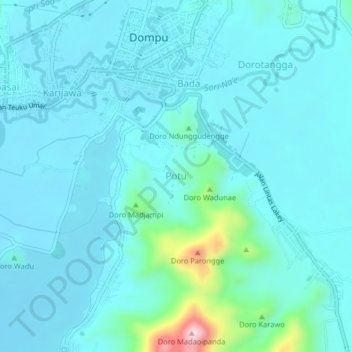
Name: Potu topographic map, elevation, terrain.
Location: Potu, Kabupaten Bima, West Nusa Tenggara, 84211, Indonesia (-8.57139 118.44533 -8.53139 118.48533)
Average elevation: 53 m
Minimum elevation: 13 m
Maximum elevation: 339 m