
A la Reine Des Belges topographic map
Interactive map
Click on the map to display elevation.
About this map
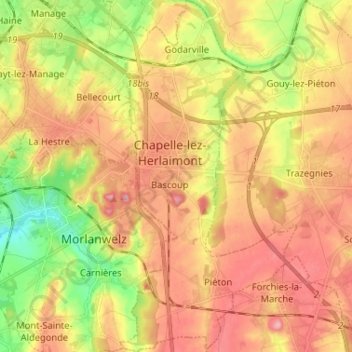
Name: A la Reine Des Belges topographic map, elevation, terrain.
Average elevation: 150 m
Minimum elevation: 82 m
Maximum elevation: 204 m
Other topographic maps
Click on a map to view its topography, its elevation and its terrain.
Le Piéton
Belgique > Wallonie > Chapelle-lez-Herlaimont
Le Piéton, Chapelle-lez-Herlaimont, Charleroi, Hainaut, Wallonie, 7160, Belgique
Average elevation: 173 m