
Kharkiv Oblast topographic map
Interactive map
Click on the map to display elevation.
About this map
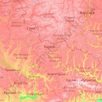
Name: Kharkiv Oblast topographic map, elevation, terrain.
Location: Kharkiv Oblast, Ukraine (47.26996 33.81890 52.38996 38.93890)
Average elevation: 149 m
Minimum elevation: 0 m
Maximum elevation: 357 m
Other topographic maps
Click on a map to view its topography, its elevation and its terrain.
Kharkiv
Based on Kharkiv's topography, the city can be conditionally divided into four lower districts and four higher districts.
Average elevation: 146 m