

Monifieth topographic map
Click on the map to display elevation.
Monifieth
The name "Monifieth" likely derives from the Gaelic "Moine Feith", "Bogstream of the marsh/moss". Previous suggestions that it comes from "Monadh Fieth" meaning "hill of the deer" make little sense. "Monadh" would mean a large upland mountainous area, which(given that the town is many miles from the highlands) is the exact opposite of Monifieths topography. An alternative etymology Monaich Fother, 'Monks' Land' has been suggested, which holds some appeal due to Monifieth's early status as a possession of the Céli Dé monastic order.
About this map
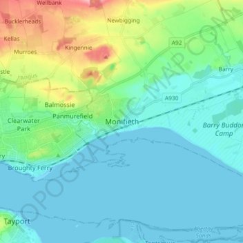
Name: Monifieth topographic map, elevation, terrain.
Location: Monifieth, Angus, Scotland, DD5 4AA, United Kingdom (56.44180 -2.85801 56.52180 -2.77801)
Average elevation: 29 m
Minimum elevation: -1 m
Maximum elevation: 145 m