
Lavita topographic map
Interactive map
Click on the map to display elevation.
About this map
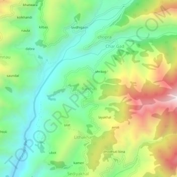
Name: Lavita topographic map, elevation, terrain.
Location: Lavita, Pauri Garhwal, Uttarakhand, Indien (29.92049 78.88656 29.96049 78.92656)
Average elevation: 1,441 m
Minimum elevation: 1,103 m
Maximum elevation: 2,030 m