Geolocate

Compton topographic map

Click on the map to display elevation.

About this map

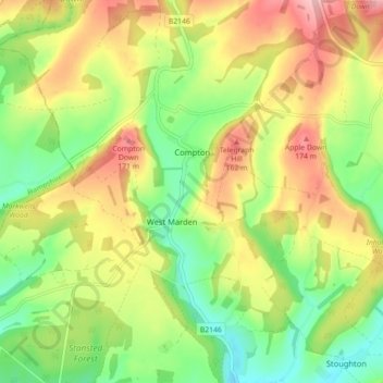
Name: Compton topographic map, elevation, terrain.

Location: Compton, Chichester, West Sussex, England, United Kingdom (50.89983 -0.94268 50.94350 -0.85385)

Average elevation: 105 m

Minimum elevation: 37 m

Maximum elevation: 187 m

Gear up for your next adventure:

🎒Dry Bags - Waterproof bags for outdoor gear
🧤Hiking Gloves - Protective gloves for outdoor use
🎧Bluetooth Outdoor Earbuds - Listen to navigation cues or podcasts during long solo treks
🔪Camping Knives - Multi-purpose outdoor knives
📍Handheld GPS - GPS devices for hiking and navigation

As an Amazon Associate, this site earns from qualifying purchases at no extra cost to you.