
Montamy topographic map
Interactive map
Click on the map to display elevation.
About this map
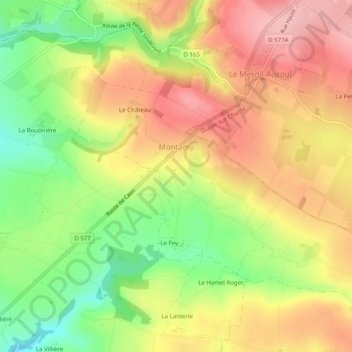
Name: Montamy topographic map, elevation, terrain.
Average elevation: 233 m
Minimum elevation: 149 m
Maximum elevation: 306 m
Le toponyme est attesté sous la forme Montamis au XIVe siècle. Issu de l'ancien français mont ayant le sens actuel, il est lié à la topographie du lieu, Amy étant un patronyme.