
Thank you for supporting this site ❤️
Make a donation
Make a donation
Gear up for your next adventure:
As an Amazon Associate, this site earns from qualifying purchases at no extra cost to you.
Galeotta topographic map
Click on the map to display elevation.
Thank you for supporting this site ❤️
Make a donation
Make a donation
Gear up for your next adventure:
As an Amazon Associate, this site earns from qualifying purchases at no extra cost to you.
About this map
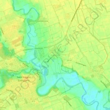
Name: Galeotta topographic map, elevation, terrain.
Location: Galeotta, Sant'Angelo Lodigiano, Lodi, Lombardy, 26851, Italy (45.22663 9.40482 45.26663 9.44482)
Average elevation: 70 m
Minimum elevation: 55 m
Maximum elevation: 80 m
Thank you for supporting this site ❤️
Make a donation
Make a donation
Gear up for your next adventure:
As an Amazon Associate, this site earns from qualifying purchases at no extra cost to you.