
Thank you for supporting this site ❤️
Make a donation
Make a donation
Gear up for your next adventure:
As an Amazon Associate, this site earns from qualifying purchases at no extra cost to you.
Dugnano topographic map
Click on the map to display elevation.
Thank you for supporting this site ❤️
Make a donation
Make a donation
Gear up for your next adventure:
As an Amazon Associate, this site earns from qualifying purchases at no extra cost to you.
About this map
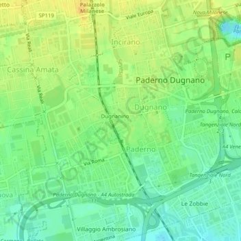
Name: Dugnano topographic map, elevation, terrain.
Location: Dugnano, Paderno Dugnano, Milan, Lombardy, 20037, Italy (45.56015 9.14675 45.57449 9.17737)
Average elevation: 165 m
Minimum elevation: 152 m
Maximum elevation: 178 m
Thank you for supporting this site ❤️
Make a donation
Make a donation
Gear up for your next adventure:
As an Amazon Associate, this site earns from qualifying purchases at no extra cost to you.