Geolocate

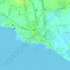
Sibulao topographic map

Click on the map to display elevation.

About this map

Name: Sibulao topographic map, elevation, terrain.

Location: Sibulao, Zamboanga City, Zamboanga Peninsula, 7000, Philippines (7.30644 122.22121 7.34644 122.26121)

Average elevation: 101 m

Minimum elevation: 11 m

Maximum elevation: 331 m

Other topographic maps

Click on a map to view its topography, its elevation and its terrain.

Sacol Island

Philippines > Zamboanga City

Average elevation: 6 m

Vitali River

Philippines > Zamboanga City > Mangusu

Average elevation: 27 m

Sinunug Island

Philippines > Zamboanga City

Average elevation: 0 m

Plaza Pershing

Philippines > Zamboanga City

Average elevation: 4 m

Gear up for your next adventure:

🧼Biodegradable Outdoor Soap - Clean gear and yourself without harming the local ecosystem
📡Portable Emergency Radios - Stay informed about weather warnings and bushfire alerts
🥤Outdoor Water Bottles - Reusable bottles for outdoor activities
🛰️Handheld GPS Units - Rugged GPS devices for tracking coordinates and elevation in the Australian bush
🩹First Aid Kits - Emergency kits for hiking

As an Amazon Associate, this site earns from qualifying purchases at no extra cost to you.