
Las Lajas topographic map
Interactive map
Click on the map to display elevation.
About this map
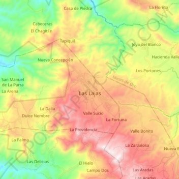
Name: Las Lajas topographic map, elevation, terrain.
Location: Las Lajas, Comayagua, Honduras (14.85612 -87.70784 14.93934 -87.55716)
Average elevation: 868 m
Minimum elevation: 322 m
Maximum elevation: 1,478 m