
Thank you for supporting this site ❤️
Make a donation
Make a donation
Gear up for your next adventure:
As an Amazon Associate, this site earns from qualifying purchases at no extra cost to you.
Virajpet topographic map
Click on the map to display elevation.
Thank you for supporting this site ❤️
Make a donation
Make a donation
Gear up for your next adventure:
As an Amazon Associate, this site earns from qualifying purchases at no extra cost to you.
About this map
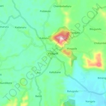
Name: Virajpet topographic map, elevation, terrain.
Location: Virajpet, Virajpet taluk, Coorg, Karnataka, 571218, India (12.15727 75.76334 12.23727 75.84334)
Average elevation: 899 m
Minimum elevation: 820 m
Maximum elevation: 1,163 m
Thank you for supporting this site ❤️
Make a donation
Make a donation
Gear up for your next adventure:
As an Amazon Associate, this site earns from qualifying purchases at no extra cost to you.