
Rattelsdorf topographic map
Interactive map
Click on the map to display elevation.
About this map
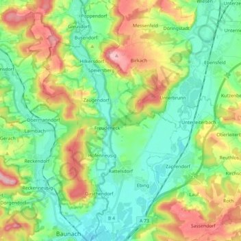
Name: Rattelsdorf topographic map, elevation, terrain.
Location: Rattelsdorf, Landkreis Bamberg, Bayern, 96179, Deutschland (49.98202 10.83199 50.09541 10.93133)
Average elevation: 290 m
Minimum elevation: 232 m
Maximum elevation: 403 m