
Thank you for supporting this site ❤️
Make a donation
Make a donation
Gear up for your next adventure:
As an Amazon Associate, this site earns from qualifying purchases at no extra cost to you.
村17 topographic map
Click on the map to display elevation.
Thank you for supporting this site ❤️
Make a donation
Make a donation
Gear up for your next adventure:
As an Amazon Associate, this site earns from qualifying purchases at no extra cost to you.
About this map
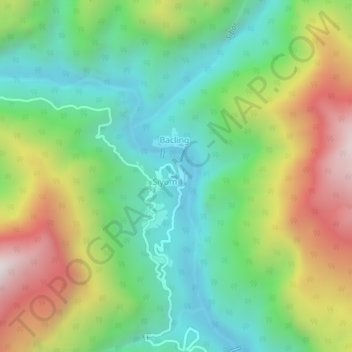
Name: 村17 topographic map, elevation, terrain.
Location: 村17, Siyum ADC, Upper Subansiri, Arunachal Pradesh, India (28.33608 94.01508 28.37608 94.05508)
Average elevation: 899 m
Minimum elevation: 401 m
Maximum elevation: 1,754 m
Thank you for supporting this site ❤️
Make a donation
Make a donation
Gear up for your next adventure:
As an Amazon Associate, this site earns from qualifying purchases at no extra cost to you.