Geolocate

Wigston topographic map

Click on the map to display elevation.

About this map

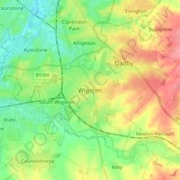
Name: Wigston topographic map, elevation, terrain.

Location: Wigston, Oadby and Wigston, Leicestershire, England, LE18 1DT, United Kingdom (52.54628 -1.14591 52.62628 -1.06591)

Average elevation: 91 m

Minimum elevation: 55 m

Maximum elevation: 141 m

Other topographic maps

Click on a map to view its topography, its elevation and its terrain.

Gear up for your next adventure:

🦯Trekking Poles - Walking poles for hiking stability
🌿Flora and Fauna Field Guides - Identify the plants and animals you encounter on your route
📕Australia Maps - Maps covering Australian regions
🍳Camping Cookware - Cookware sets for outdoor meals
🎽Hiking Clothing - Breathable clothing for hiking

As an Amazon Associate, this site earns from qualifying purchases at no extra cost to you.