Geolocate

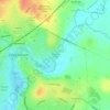
Patterdown topographic map

Click on the map to display elevation.

About this map

Name: Patterdown topographic map, elevation, terrain.

Location: Patterdown, Chippenham, Wiltshire, England, SN15 2NR, United Kingdom (51.42935 -2.15318 51.46935 -2.11318)

Average elevation: 65 m

Minimum elevation: 39 m

Maximum elevation: 109 m

Other topographic maps

Click on a map to view its topography, its elevation and its terrain.
Monkton Park

United Kingdom > England > Wiltshire > Chippenham

Average elevation: 59 m

Gear up for your next adventure:

💡Collapsible Camping Lanterns - Illuminate your base camp or tent for map studying at night
📡Weather Radios - Emergency weather radios
🧴SPF 50+ Bulk Sunscreen - Maximum protection for long-term outdoor exposure
☕Outdoor Coffee Makers - Enjoy quality coffee at the summit of your favorite peak
📱Shockproof Phone Cases - Extra protection for your smartphone against drops on rocky terrain

As an Amazon Associate, this site earns from qualifying purchases at no extra cost to you.