Geolocate

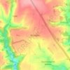
Winstone topographic map

Click on the map to display elevation.

About this map

Name: Winstone topographic map, elevation, terrain.

Location: Winstone, Cotswold District, Gloucestershire, England, United Kingdom (51.77020 -2.08411 51.79600 -2.02178)

Average elevation: 222 m

Minimum elevation: 138 m

Maximum elevation: 276 m

Other topographic maps

Click on a map to view its topography, its elevation and its terrain.
Gear up for your next adventure:

🛰️Handheld GPS Units - Rugged GPS devices for tracking coordinates and elevation in the Australian bush
🔥Ferrocerium Rod Fire Starters - Reliable fire lighting in wet or windy conditions without matches
📱Shockproof Phone Cases - Extra protection for your smartphone against drops on rocky terrain
🥾Heavy Duty Hiking Boots - Ankle-supporting boots for carrying heavy packs on steep contours
🧼Biodegradable Soap - Eco-friendly outdoor soap

As an Amazon Associate, this site earns from qualifying purchases at no extra cost to you.