Geolocate

Grovedale topographic map

Click on the map to display elevation.

About this map

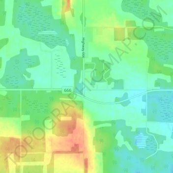
Name: Grovedale topographic map, elevation, terrain.

Location: Grovedale, Division No. 18, Alberta, Canada (55.00591 -118.88374 55.04591 -118.84374)

Average elevation: 673 m

Minimum elevation: 658 m

Maximum elevation: 700 m

Gear up for your next adventure:

🥶Thermal Beanies - Warm hats for cold hikes
🪢550 Survival Paracord - Versatile cordage for gear repair and emergency lashing
🔦LED Torches - LED torches for outdoor use
🖼️Scratch-off Australia Map - Track the regions and peaks you have explored geographically
📡Weather Radios - Emergency weather radios

As an Amazon Associate, this site earns from qualifying purchases at no extra cost to you.