
Buwunde-bamba topographic map
Interactive map
Click on the map to display elevation.
About this map
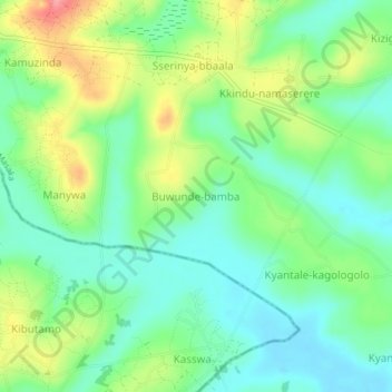
Name: Buwunde-bamba topographic map, elevation, terrain.
Location: Buwunde-bamba, Masaka, Central Region, Uganda (-0.53684 31.67677 -0.49684 31.71677)
Average elevation: 1,206 m
Minimum elevation: 1,170 m
Maximum elevation: 1,273 m