Geolocate

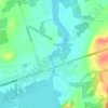
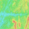
Coboconk topographic map

Click on the map to display elevation.

About this map

Name: Coboconk topographic map, elevation, terrain.

Location: Coboconk, Kawartha Lakes, Central Ontario, Ontario, K0M 1K0, Canada (44.63858 -78.81819 44.67858 -78.77819)

Average elevation: 275 m

Minimum elevation: 253 m

Maximum elevation: 311 m

Other topographic maps

Click on a map to view its topography, its elevation and its terrain.

Cameron Lake

Canada > Ontario > Kawartha Lakes > Fenelon Falls

Average elevation: 262 m

Pigeon River

Canada > Ontario > Kawartha Lakes > Omemee

Average elevation: 259 m

Dalrymple Lake

Canada > Ontario > Kawartha Lakes

Average elevation: 241 m

Head Lake

Canada > Ontario > Kawartha Lakes

Average elevation: 278 m

Sturgeon Lake

Canada > Ontario > Kawartha Lakes

Average elevation: 266 m

Emily Provincial Park

Canada > Ontario > Kawartha Lakes

Average elevation: 259 m

Young Lake

Canada > Ontario > Kawartha Lakes

Average elevation: 231 m

Four Mile Lake

Canada > Ontario > Kawartha Lakes

Average elevation: 282 m

Victoria Lake

Canada > Ontario > Kawartha Lakes

Average elevation: 308 m

Gear up for your next adventure:

🧥Packable Rain Jackets - Breathable waterproof layers for unpredictable mountain weather
🦟Insect Repellent - Protection against insects
💧Personal Water Filters - Drink safely from streams and lakes identified on your map
☀️Portable Solar Chargers - High-efficiency panels to hang on your backpack while walking
🧊Insulated Stainless Steel Flasks - Keep water cold for 24 hours in the heat or coffee hot in the cold

As an Amazon Associate, this site earns from qualifying purchases at no extra cost to you.