
Charguayacu topographic map
Interactive map
Click on the map to display elevation.
About this map
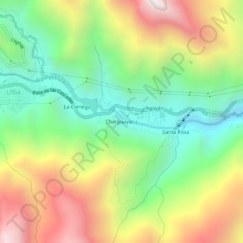
Name: Charguayacu topographic map, elevation, terrain.
Location: Charguayacu, Ulba, Baños, Tungurahua, 180350, Équateur (-1.42038 -78.39817 -1.38038 -78.35817)
Average elevation: 2,115 m
Minimum elevation: 1,492 m
Maximum elevation: 2,977 m