
Градска општина Чукарица topographic map
Interactive map
Click on the map to display elevation.
About this map
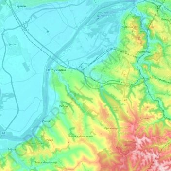
Name: Градска општина Чукарица topographic map, elevation, terrain.
Average elevation: 133 m
Minimum elevation: 67 m
Maximum elevation: 333 m
Other topographic maps
Click on a map to view its topography, its elevation and its terrain.
Belgrade
Serbie > Serbie centrale > Ville de Belgrade
Belgrade, Ville de Belgrade, Serbie centrale, 11000, Serbie
Average elevation: 108 m