Geolocate

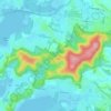
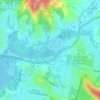
Mount White topographic map

Click on the map to display elevation.

About this map

Name: Mount White topographic map, elevation, terrain.

Location: Mount White, Gosford, New South Wales, Australia (-33.47588 151.15837 -33.42807 151.22110)

Average elevation: 123 m

Minimum elevation: -1 m

Maximum elevation: 269 m

New South Wales trails, hiking, mountain biking, running and outdoor activities

Other topographic maps

Click on a map to view its topography, its elevation and its terrain.
Mount White

Australia > New South Wales > Gosford

Average elevation: 139 m

Wyong River

Australia > New South Wales > Gosford

Average elevation: 175 m

Wamberal Beach

Australia > New South Wales > Gosford

Average elevation: 7 m

Mount Elliot

Australia > New South Wales > Gosford

Average elevation: 92 m

Erina Creek

Australia > New South Wales > Gosford

Average elevation: 23 m

Gear up for your next adventure:

🎧Bluetooth Outdoor Earbuds - Listen to navigation cues or podcasts during long solo treks
🥾Hiking Shoes - Lightweight hiking shoes for day hikes
📣High-Decibel Survival Whistles - Signaling tool for rescue that carries much further than a human voice
🍶Collapsible Water Bottles - Save space in your pack as you consume your water supply
🥶Thermal Beanies - Warm hats for cold hikes

As an Amazon Associate, this site earns from qualifying purchases at no extra cost to you.