Geolocate

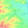
Walag topographic map

Click on the map to display elevation.

About this map

Name: Walag topographic map, elevation, terrain.

Location: Walag, Deglur, Nanded District, Maharashtra, 431718, India (18.44969 77.43821 18.48969 77.47821)

Average elevation: 427 m

Minimum elevation: 389 m

Maximum elevation: 477 m

Other topographic maps

Click on a map to view its topography, its elevation and its terrain.
Lendi

India > Maharashtra > Deglur

Average elevation: 396 m

Gear up for your next adventure:

🩹First Aid Kits - Emergency kits for hiking
🧦Hiking Socks - Comfortable socks for long hikes
🌬️Windbreaker Jackets - Wind protection jackets
🧊Insulated Stainless Steel Flasks - Keep water cold for 24 hours in the heat or coffee hot in the cold
🎽Hiking Clothing - Breathable clothing for hiking

As an Amazon Associate, this site earns from qualifying purchases at no extra cost to you.