
Thank you for supporting this site ❤️
Make a donation
Make a donation
Gear up for your next adventure:
As an Amazon Associate, this site earns from qualifying purchases at no extra cost to you.
Rioseco topographic map
Click on the map to display elevation.
Thank you for supporting this site ❤️
Make a donation
Make a donation
Gear up for your next adventure:
As an Amazon Associate, this site earns from qualifying purchases at no extra cost to you.
About this map
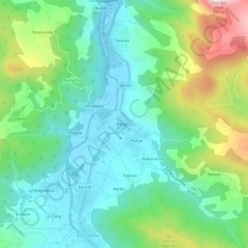
Name: Rioseco topographic map, elevation, terrain.
Location: Rioseco, Guriezo, Cantabria, 39788, Spain (43.34468 -3.33745 43.38468 -3.29745)
Average elevation: 154 m
Minimum elevation: -1 m
Maximum elevation: 537 m
Thank you for supporting this site ❤️
Make a donation
Make a donation
Gear up for your next adventure:
🧭Military Style Lensatic Compass - Durable sighting compasses for advanced land navigation and surveying
As an Amazon Associate, this site earns from qualifying purchases at no extra cost to you.