Geolocate

Guavate topographic map

Click on the map to display elevation.

About this map
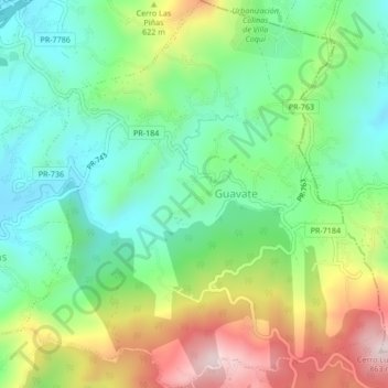
Name: Guavate topographic map, elevation, terrain.

Location: Guavate, Cayey, Puerto Rico, United States (18.11253 -66.09948 18.15259 -66.06030)

Average elevation: 557 m

Minimum elevation: 388 m

Maximum elevation: 859 m

Other topographic maps

Click on a map to view its topography, its elevation and its terrain.

Cayey

United States > Puerto Rico > Cayey

Average elevation: 489 m

Gear up for your next adventure:

🧴SPF 50+ Bulk Sunscreen - Maximum protection for long-term outdoor exposure
📚Map Reading & Navigation Guides - Master the art of interpreting topographic contours and symbols
🔌Fast Charging Adapters - Quickly top up all your gear before heading back into the field
⌚GPS Watches - GPS watches for outdoor sports
🎒Hiking Backpacks - Backpacks designed for hiking and trekking

As an Amazon Associate, this site earns from qualifying purchases at no extra cost to you.