Geolocate

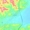
Ixtlán topographic map

Click on the map to display elevation.

Ixtlán

It has an average altitude of 1,530 meters above sea level, being on the north of the Trans-Mexican Volcanic Belt and the Lerma-Chapala Depression. There are some elevations including the hills called El Comalito, Divisadero, Gordo, Encinal and Coyote.

Wikipedia (CC-BY-SA 3.0)

About this map

Name: Ixtlán topographic map, elevation, terrain.

Location: Ixtlán, Michoacán, Mexico (20.07385 -102.47410 20.22472 -102.35564)

Average elevation: 1,603 m

Minimum elevation: 1,522 m

Maximum elevation: 2,136 m

Other topographic maps

Click on a map to view its topography, its elevation and its terrain.

Angahuan

Mexico > Michoacán > Uruapan

Average elevation: 2,403 m

Morelia

Mexico > Michoacán > Morelia

Under the Köppen climate classification, Morelia has a subtropical highland climate (abbreviated Cwb on climate maps), with warm-to-hot days and cool nights year round due to its high elevation. Most precipitation falls during the summer monsoon season from June to September. Average monthly temperatures are…

Average elevation: 2,071 m

El Jorullo

Mexico > Michoacán > Ario

Average elevation: 969 m

Jaripo

Mexico > Michoacán > Villamar

Average elevation: 1,621 m

Faro de Bucerías

Mexico > Michoacán > Aquila

Average elevation: 31 m

Zamora

Mexico > Michoacán > Zamora

The city of Zamora is an important economic center in the state and the most significant population center between the cities of Morelia and Guadalajara. The city is located on the Tarascan Plateau in the northwestern part of the state, at an elevation of 1,567 m (5,141 ft) above sea level. Zamora is…

Average elevation: 1,798 m

Atapaneo

Mexico > Michoacán > Morelia

Average elevation: 1,923 m

La Piedad de Cabadas

Mexico > Michoacán > La Piedad

Average elevation: 1,754 m

Pátzcuaro

Mexico > Michoacán > Pátzcuaro

Average elevation: 2,196 m

Coenembo

Mexico > Michoacán > Tzintzuntzan

Average elevation: 2,207 m

Zitácuaro

Mexico > Michoacán > Zitácuaro

Zitácuaro stands at 19°26′N 100°22′W / 19.433°N 100.367°W / 19.433; -100.367, in the northeast corner of Michoacán, some 150 km east of state capital Morelia, at an elevation of 1,942 metres above sea level. The municipality covers a total of 498 km2 and is drained by the Río Zitácuaro,…

Average elevation: 2,157 m

Tarímbaro

Mexico > Michoacán > Tarímbaro

Average elevation: 1,927 m

Angahuan

Mexico > Michoacán > Uruapan > Angahuan

Average elevation: 2,403 m

Parícutin

Mexico > Michoacán > Uruapan

Average elevation: 2,555 m

Ario de Rosales

Mexico > Michoacán > Ario

Average elevation: 1,861 m

Zamora

Mexico > Michoacán > Zamora

The city of Zamora is an important economic center in the state and the most significant population center between the cities of Morelia and Guadalajara. The city is located on the Tarascan Plateau in the northwestern part of the state, at an elevation of 1,567 m (5,141 ft) above sea level. Zamora is…

Average elevation: 1,798 m

Janitzio

Mexico > Michoacán > Pátzcuaro

Average elevation: 2,040 m

Agua Caliente

Mexico > Michoacán > Coeneo

Average elevation: 2,048 m

Uruapan

Mexico > Michoacán > Uruapan

Average elevation: 1,800 m

Sahuayo de Morelos

Mexico > Michoacán > Sahuayo

Average elevation: 1,596 m

Tocuaro

Mexico > Michoacán

Average elevation: 2,069 m

Zináparo

Mexico > Michoacán > Zináparo

Average elevation: 1,857 m

Los Reyes de Salgado

Mexico > Michoacán > Los Reyes

Average elevation: 1,387 m

La Cantera

Mexico > Michoacán > Pátzcuaro

Average elevation: 2,498 m

San Juan de Alima

Mexico > Michoacán > Aquila

Average elevation: 84 m

Napízaro

Mexico > Michoacán

Average elevation: 2,076 m

Aranza

Mexico > Michoacán > Paracho

Average elevation: 2,259 m

Presa Las Adjuntas

Mexico > Michoacán > Zináparo

Average elevation: 1,758 m

Cuanajillo del Toro

Mexico > Michoacán > Morelia

Average elevation: 2,414 m

La Ruana

Mexico > Michoacán > Buenavista

Average elevation: 323 m

Venta de Bravo

Mexico > Michoacán > Contepec

Average elevation: 2,334 m

Morelia

Mexico > Michoacán > Morelia

Under the Köppen climate classification, Morelia has a subtropical highland climate (abbreviated Cwb on climate maps), with warm-to-hot days and cool nights year round due to its high elevation. Most precipitation falls during the summer monsoon season from June to September. Average monthly temperatures are…

Average elevation: 2,071 m

Tarecuato

Mexico > Michoacán > Tangamandapio

Average elevation: 2,040 m

Tocuaro

Mexico > Michoacán

Average elevation: 2,069 m

Paracho de Verduzco

Mexico > Michoacán > Paracho

Average elevation: 2,368 m

Álvaro Obregón

Mexico > Michoacán > Álvaro Obregón

Average elevation: 1,862 m

Santa Juana

Mexico > Michoacán > Pátzcuaro

Average elevation: 2,557 m

Uruapan

Mexico > Michoacán > Uruapan

Average elevation: 1,800 m

Parícuaro

Mexico > Michoacán > Juárez

Average elevation: 1,283 m

Gear up for your next adventure:

🧼Biodegradable Outdoor Soap - Clean gear and yourself without harming the local ecosystem
🥾Hiking Shoes - Lightweight hiking shoes for day hikes
🪑Portable Backpacking Chairs - A comfortable seat for studying maps at the end of the day
☀️Portable Solar Chargers - High-efficiency panels to hang on your backpack while walking
🧼Biodegradable Soap - Eco-friendly outdoor soap

As an Amazon Associate, this site earns from qualifying purchases at no extra cost to you.