Rimburg topographic map
Click on the map to display elevation.
Rimburg
Rimburg is een langgerekt dorp dat parallel verloopt aan de Worm. De hoogte van het dorp is ongeveer 95 meter. Op de hellingen van het plateau naar het dal liggen enkele hellingbossen, zoals het Rimburgerbos, waarin zich ook de watertoren en de Sint-Jozefkapel bevindt.
About this map
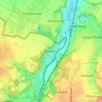
Name: Rimburg topographic map, elevation, terrain.
Location: Rimburg, Landgraaf, Limburg, Nederland, 6374 LR, Nederland (50.89573 6.06441 50.93573 6.10441)
Average elevation: 116 m
Minimum elevation: 77 m
Maximum elevation: 166 m
Other topographic maps
Click on a map to view its topography, its elevation and its terrain.