
Brichambeau topographic map
Interactive map
Click on the map to display elevation.
About this map
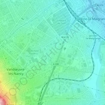
Name: Brichambeau topographic map, elevation, terrain.
Average elevation: 236 m
Minimum elevation: 198 m
Maximum elevation: 381 m
Other topographic maps
Click on a map to view its topography, its elevation and its terrain.
Brabois
France > Grand Est > Meurthe-et-Moselle > Vandœuvre-lès-Nancy
Brabois, Vandœuvre-lès-Nancy, Nancy, Meurthe-et-Moselle, Grand Est, France métropolitaine, 54500, France
Average elevation: 359 m
Charmois
France > Grand Est > Meurthe-et-Moselle > Vandœuvre-lès-Nancy
Charmois, Vandœuvre-lès-Nancy, Nancy, Meurthe-et-Moselle, Grand Est, France métropolitaine, 54500, France
Average elevation: 240 m