Geolocate

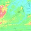
Rio Bitury topographic map

Click on the map to display elevation.

About this map

Other topographic maps

Click on a map to view its topography, its elevation and its terrain.

Taboquinha

Brasil > Pernambuco > Belo Jardim

Average elevation: 766 m

Serra do Vento

Brasil > Pernambuco > Belo Jardim

Average elevation: 622 m

Água Fria

Brasil > Pernambuco > Belo Jardim

Average elevation: 674 m

Xucuru

Brasil > Pernambuco > Belo Jardim

Average elevation: 777 m

Gear up for your next adventure:

🧥Thermal Emergency Blankets - Compact Mylar blankets to prevent hypothermia if stranded overnight
🎒Hiking Backpacks - Backpacks designed for hiking and trekking
🧭Military Style Lensatic Compass - Durable sighting compasses for advanced land navigation and surveying
⛺Ultralight Solo Tents - Compact shelters for multi-day topographic surveying expeditions
🗺️Topographic Maps - Detailed maps for hiking and navigation

As an Amazon Associate, this site earns from qualifying purchases at no extra cost to you.