
Zufre topographic map
Interactive map
Click on the map to display elevation.
About this map
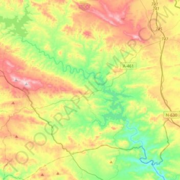
Name: Zufre topographic map, elevation, terrain.
Location: Zufre, Sierra de Huelva, Huelva, Andalusia, Spain (37.71886 -6.48508 37.95640 -6.20570)
Average elevation: 425 m
Minimum elevation: 153 m
Maximum elevation: 831 m
Other topographic maps
Click on a map to view its topography, its elevation and its terrain.
La Nava
Spain > Andalusia > Sierra de Huelva
La Nava, Sierra de Huelva, Huelva, Andalusia, Spain
Average elevation: 490 m