
Romeria topographic map
Interactive map
Click on the map to display elevation.
About this map
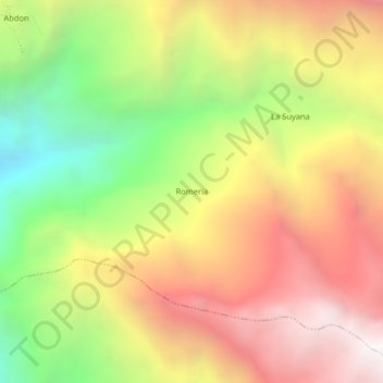
Name: Romeria topographic map, elevation, terrain.
Location: Romeria, Longotea, Bolívar, La Libertad, Perú (-7.10998 -77.87562 -7.06998 -77.83562)
Average elevation: 3,022 m
Minimum elevation: 1,964 m
Maximum elevation: 3,991 m